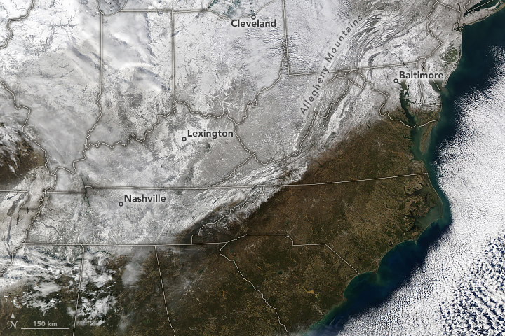
Snow Blankets Eastern U.S. After Arctic Blast
Jan 23, 2024
More than a week of storms and bitterly cold temperatures left a blanket of snow across much of the eastern United States. The winter weather was brought on by fronts of Arctic air that swept across the country in mid-January.
Starting on January 13, a cold front brought sub-zero wind chills to over 100 million Americans. The system dropped several inches of snow in parts of Mississippi and Tennessee and buried cities downwind of the Great Lakes in multiple feet of lake-effect snow.
Over the next two days, parts of Tennessee saw accumulations of 5 to 8 inches (13 to 20 centimeters). More than 6 inches fell on Nashville on January 15, breaking the city’s record for that date and exceeding its average annual snowfall of about 5 inches. Icy, snowy roads created hazardous driving conditions in the state, which led to a high number of fatalities, according to news reports.
Another blast of cold air plunged south from Canada and moved through the eastern U.S. on January 19 and 20, piling on more wintery precipitation. The skies cleared on January 21, 2024, when the MODIS (Moderate Resolution Imaging Spectroradiometer) instrument on NASA’s Aqua satellite captured this image. The band of snow stretched from Mississippi to Maine.
According to the National Weather Service, 2 to 5 inches of snow remained on the ground near Baltimore, Maryland, on January 21. The snowfall in Washington, D.C., and New York City ended their two-year streaks without measurable accumulation. Around 2 feet of snow persisted on parts of the Allegheny Mountains.
According to the Weather Channel, snow has fallen in all 50 states as of January 17. They reported that the recent Arctic blast brought flurries to Milton, in Florida’s panhandle, and a previous storm left a dusting of snow at high elevations in Hawaii.
NASA Earth Observatory image by Michala Garrison, using MODIS data from NASA EOSDIS LANCE and GIBS/Worldview. Story by Emily Cassidy.
